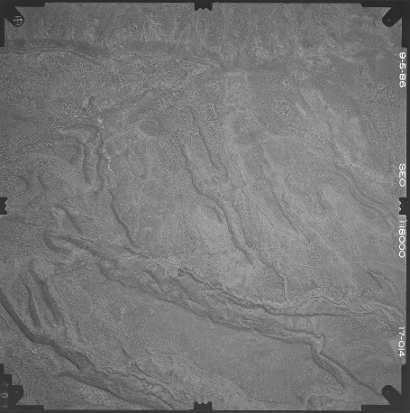
Starting raster: non-geo-image.tif
This is a raster straight out of the scanner with no geo data at all.
If you use this command to generate a translated tif...
        gdal_translate \
        -gcp 7316.36485274 8071.83316534 -107.758039329 35.0501657121 \
        -gcp 8402.66585438 7135.48163487 -107.759827472 35.0561469722 \
        -gcp 2242.45639366 5050.93463782 -107.782539576 35.0357630831 \
        -gcp 1874.51055042 5372.59940999 -107.781662474 35.0339431383 \
        -gcp 840.007167909 7469.58989578 -107.774228432 35.0267381321 \
        -gcp 6759.73032675 5308.48636671 -107.772176383 35.0526406667 \
        -gcp 1856.01940134 8439.39861605 -107.767653202 35.0288216989 \
        -of GTiff \
        -a_srs EPSG:4326 \
        non-geo-image.tif \
        translated.tif
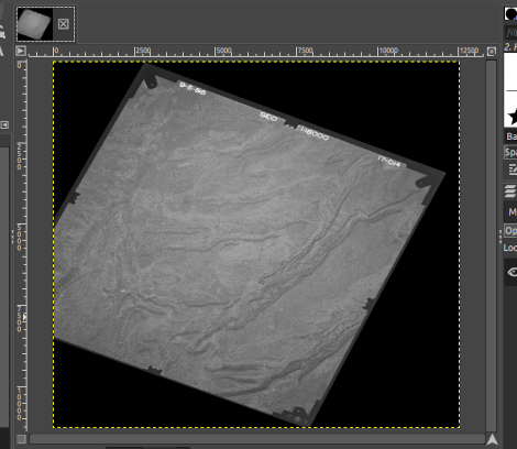
...and open the raster in Qgis you will see that the corner of the data is outside of the original raster dimensions.
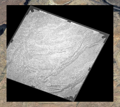
The data is not yet lost as Qgis is doing the warping on the fly using the translated raster GCPs, but once the raster is warped with gdalwarp this data appears to be lost.
gdalwarp translated.tif warped.tif
Is this the expected behavior?